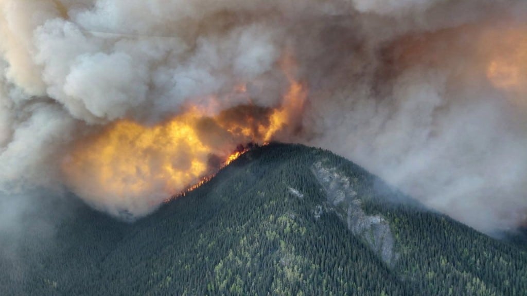
Wildfire picture evolves rapidly as firefighters tackle blazes across northeast B.C.
A fast-moving wildfire picture in northeast B.C. has seen some blazes spread and others contained by the BC Wildfire Service (BCWS).
Updated June 9th 7:20 p.m. This article has been updated to reflect further growth in the fires listed below.
FORT ST. JOHN, B.C. — A fast-moving wildfire picture in northeast B.C. has seen some blazes spread and others contained.
The BC Wildfire Service (BCWS) is tackling numerous forest fires in the Fort Nelson, Fort St. John and Dawson Creek fire zones, including three fires of note: near Summit Lake, the Kiskatinaw River and in Pocket Knife Creek.
Strong winds and rising temperatures this weekend was expected to drive ‘extreme’ wildfire behaviour, and various evacuation alerts and orders were issued on Saturday, June 7th and Sunday, June 8th as the blazes developed.
Here’s how other wildfires changed amid the difficult conditions:
- A wildfire south of the Kiwigana River which was initially reported this year on May 8th is now classed as ‘being held’ by the BCWS. This means it is projected – based on fuel, weather conditions and resource availability – to remain within the current perimeter, control line or boundary. It is an ’overwintering’ wildfire which first ignited in 2023, having smouldered underground in the winters since then.
- A blaze near the Fontas River, which prompted an evacuation order to be issued by Fort Nelson First Nation, has decreased from 127,000 hectares to 7,207 hectares. Another fire in a different place but near the same river has grown from 546 hectares to 686 hectares. These are both also the result of ‘overwintering’ wildfires, also known as ‘overwintering’ fires.
- A further ‘overwintering’ incident, the Etcho Creek wildfire has merged with two other fires – near Etset Lake and in Shush Creek – to create one large burn of 190,598 hectares. This is up from around 127,500 hectares last week.
- The Kiskatinaw River fire, designated a ‘wildfire of note’ by the BCWS, has expanded to burn over 21,000 hectares. It is close to the Kelly Lake community and has prompted numerous evacuation orders and alerts in both B.C. and Alberta.
- Another ‘wildfire of note’ near Summit Lake has grown from 8,354 hectares to 38,499 hectares. It has also prompted evacuation orders and alerts, and closed Highway 97 (the Alaska Highway) between kilometre 485 and kilometre 648.
- A fire near the Etthithun River has ballooned from 20 hectares to 2,541 hectares.
- The cluster of wildfires around Highway 52 south of Dawson Creek has been officially extinguished by the BCWS.
All the active wildfires listed above are suspected to have been caused by lightning strikes.
Latest Stories
This comes as the BCWS expects more ‘extreme’ fire behaviour as the forecasts predict a second cold front to move across northeast B.C.
Stay connected with local news
Make us your
home page
Authors

Related Articles
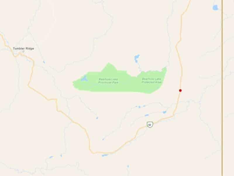
(UPDATE) Wildfire reported near Bearhole Lake Provincial Park
A wildfire has been reported near Bearhole Lake Provincial Park, adjacent to Highway 52.
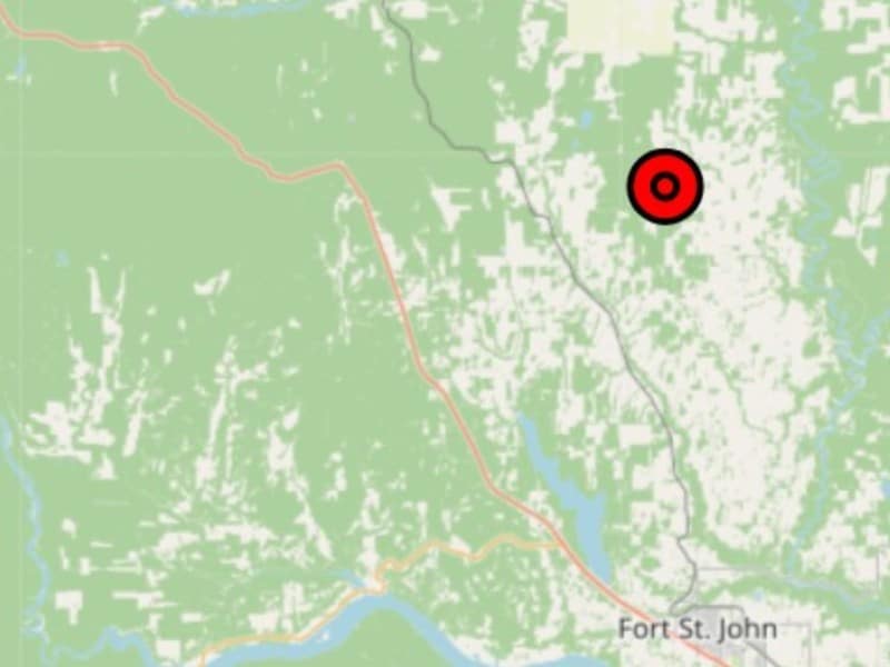
(UPDATE) BCWS fights wildfire north of Fort St. John
The one-hectare wildfire was reported during the afternoon of Wednesday, May 13th.
Windy Creek wildfire ‘under control’ at 206 hectares
The BC Wildfire Service has brought a 206 hectare wildfire northeast of Chetwynd under control after two days.
