NRRM issues evacuation order, extends alert due to Summit Lake wildfire
The Northern Rockies Regional Municipality (NRRM) has issued an evacuation order and extended an evacuation alert due to the wildfire near Summit Lake, along Highway 97 (the Alaska Highway).
FORT NELSON, B.C. — The Northern Rockies Regional Municipality (NRRM) has issued an evacuation order and extended an evacuation alert due to the wildfire near Summit Lake.
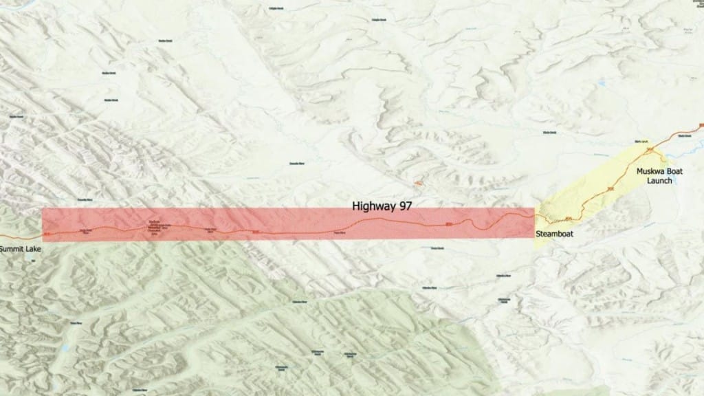
It upgraded the evacuation alert issued on June 2nd this morning (June 6th) for an area straddling Highway 97, near Summit Lake and the Tetsa River.
People in these areas must leave immediately:
- Along the Alaska Highway corridor from Summit Lake Campground within Stone Mountain Provincial Park (mile 392, kilometre 630) from the northwest point (58°42’2.23″N, 124°39’43.41″W) to the southwest point of (58°38’16.21″N, 124°39’40.50″W).
- To the Steamboat Mountain brake check (mile 333, kilometre 536) at the northeast point (58°42’2.38″N, 123°45’29.44″W) to the southeast point (58°38’43.58″N, 123°45’30.02″W).
- Excluding the Alaska Highway corridor (Highway 97), subject to closures as directed by BC Wildfire Service (BCWS).
Anyone in areas under evacuation orders should leave straight away or risk “fatal” consequences, the BC Wildfire Service warned yesterday (June 5th).
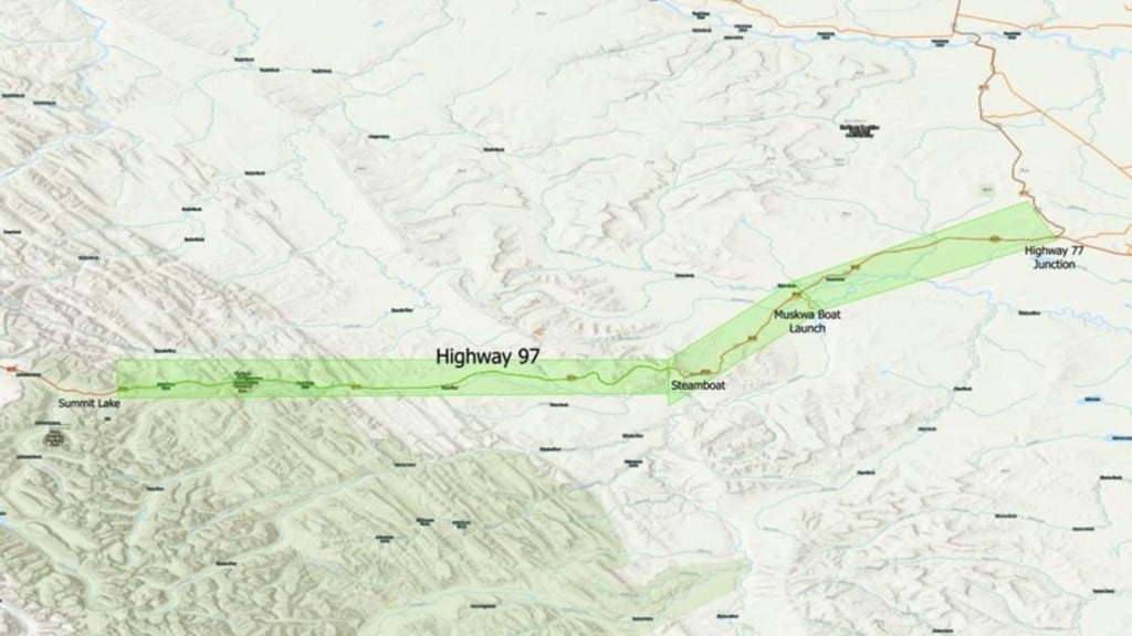
The NRRM has also extended its evacuation alert to encompass the following areas:
- Along the Alaska Highway corridor from the Steamboat Mountain brake check (mile 333, kilometre 536); at the northwest point (58°42’3.67″N, 123°45’29.06″W) to the southwest point (58°37’33.59″N, 123°45’26.79″W).
- Along the Alaska Highway corridor to and including the Muskwa River boat launch (mile 319, kilometre 513) from the northeast point (58°49’40.54″N, 123°33’19.88″W) to the southeast point of (58°46’58.04″N, 123°30’19.24″W).
Latest Stories
An evacuation alert means people in that area do not need to leave yet, but should be ready to leave at a moment’s notice.
The NRRM advises those under an evacuation alert to locate all family members and designate a meeting place outside the evacuation area; fill gas tanks, arrange accomodation if possible; and pack essential items such as an ID, medications, eyeglasses, papers (insurance, credit and mortgage information) and, if time and space permits, keepsakes.
It advised people under an evacuatation order to follow the route provided; close all windows and doors; to avoid using a telephone unless in an emergency; shut off all gas and electrical appliances other than refrigerators and freezers; close and latch gates, but do not lock them; gather family/co-workers and ensure everyone is accounted for; take anyone who needs help; take pets in kennels or on a leash; and pick up critical items such as medicines, purses, wallets and keys if they are immediately available.
Anyone who needs help with transportation or has any other queries should contact the Emergency Operations Centre at 250-775-0933.
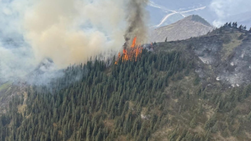
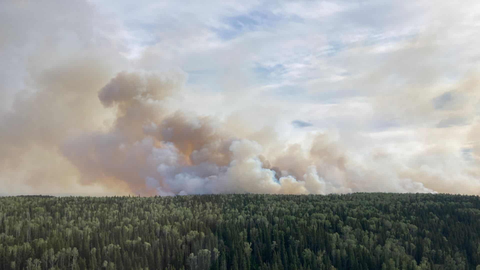
The fire, first discovered on May 28th, is believed to have been caused by a lightning strike and has burned 8,354 hectares so far, according to the BCWS.
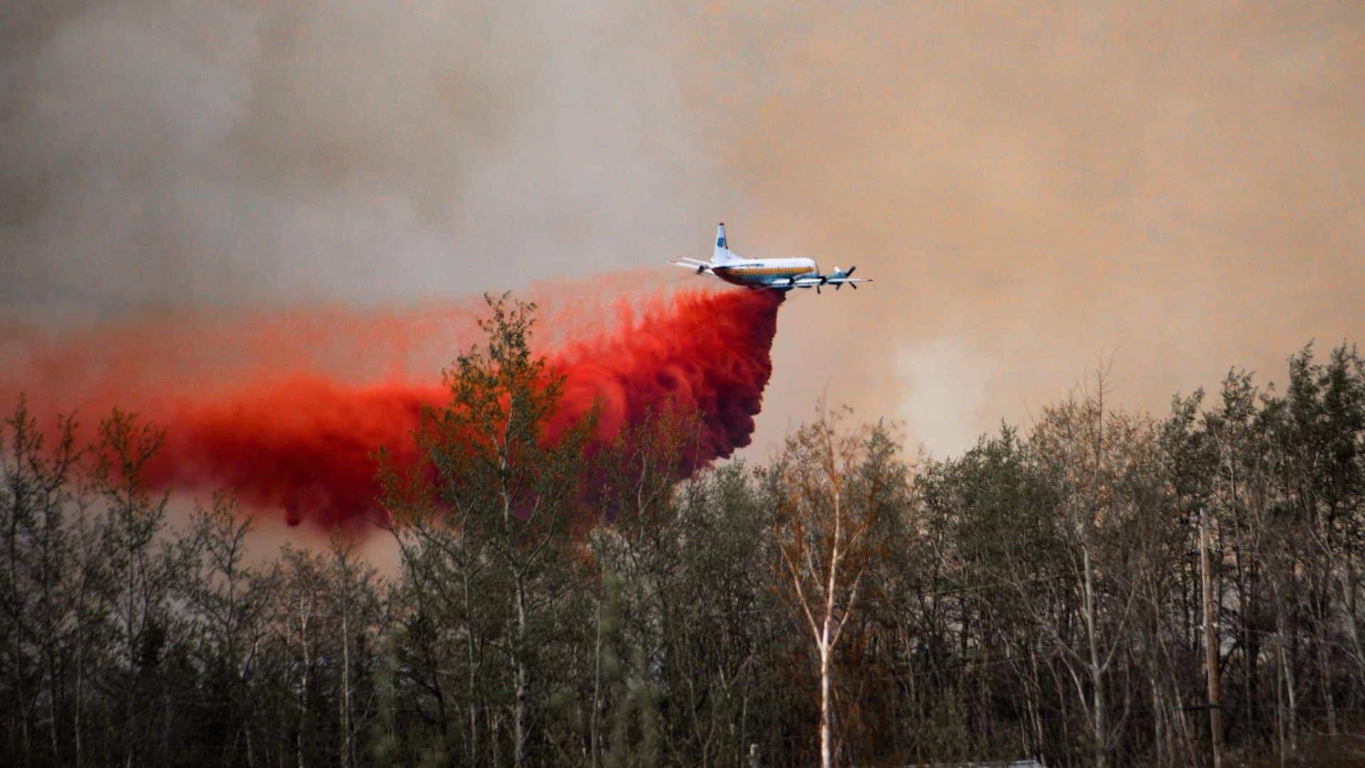
The service says there are 57 firefighters tackling the blaze, working with 15 aviation resources allocated to the Fort Nelson fire zone, a piece of heavy equipment and structural specialists.
It conducted aerial ignitions on June 2rd and 3rd to establish a control line by removing fuel from the southeastern perimeter to the North Tetsa River on the north side of Highway 97.
“This fire is burning in incredibly rugged and difficult terrain with very limited natural barriers or breaks in fuel continuity,” says BCWS.
The NRRM has declared a state of local emergency due to the wildfire. This gives its employees and agents powers to require an evacuation. It will remain in place until June 19th at midnight unless cancelled, according to a notice on the NRRM’s website.
DriveBC reports the Alaska Highway (Highway 97) is currently only open to single-lane alternating traffic between Grouse Trail and Toad Mountain Road due to the fire. However, it reminded residents the road status could change quickly, depending on the wildfire’s status.
This all comes as the BCWS braces for “extreme” wildfire behaviour this weekend (June 6th to 8th) amid a forecast of high winds and rising temperatures.
Stay connected with local news
Make us your
home page
Authors

Related Articles
‘Important investment’: B.C. forestry ministry praises $257.6 million federal boost to wildfire fighting
A recent $257.6 million investment to Natural Resources Canada will go towards Canada’s firefighting capacity, including in B.C.
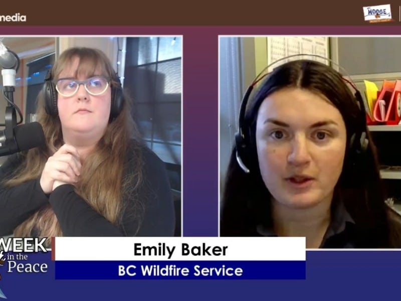
Video This Week in the Peace – BC Wildfire Service & Dawson Creek Firefighter Update
On this episode of This Week in the Peace, we get updates from the BC Wildfire Service and Dawson Creek Firefighter Capt. Brooks Gower
B.C. government slapped with $750K+ fine over incidents, including wildland firefighter’s fatal rollover near Fort St. John
WorkSafeBC has listed a $759,368.84 penalty dated September 25th, 2025 issued to the government after it investigated two incidents involving wildfire suppression, one of which involved a firefighter’s death.
