Fort Nelson at ‘extreme’ risk of wildfires, as well as spots near Fort St. John and Dawson Creek
The BC Wildfire Service says areas in northeast B.C. are at an ‘extreme’ risk of wildfires, including a large parcel engulfing Fort Nelson and spots near Fort St. John and Dawson Creek.
FORT NELSON, B.C. — Areas in northeast B.C. are at an ‘extreme’ risk of wildfires, including a large parcel engulfing Fort Nelson and spots near Fort St. John and Dawson Creek.
That’s according to the BC Wildfire Service (BCWS), which gave them the designation because “new fires will start easily, spread rapidly and challenge fire suppression efforts” in those regions.
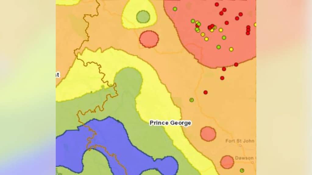
The Fort Nelson hotspot reaches from B.C.’s northern and eastern borders to near Fontas River in the south and Nelson Forks to the west.
The other two smaller areas also labelled as an ‘extreme fire danger’ are west of Fort St. John and west of Dawson Creek.
This comes as warmer temperatures are heading for the region, with forecasters predicting it will hit 29 C on Wednesday, May 28th.
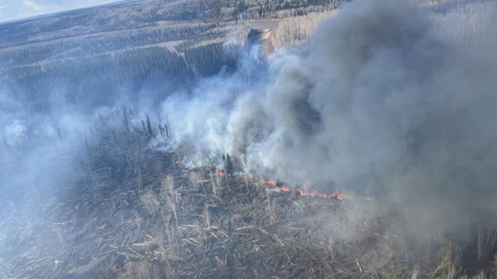
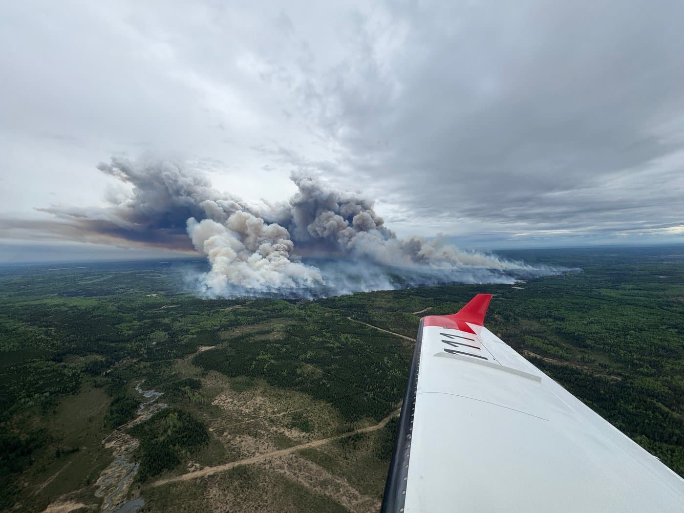
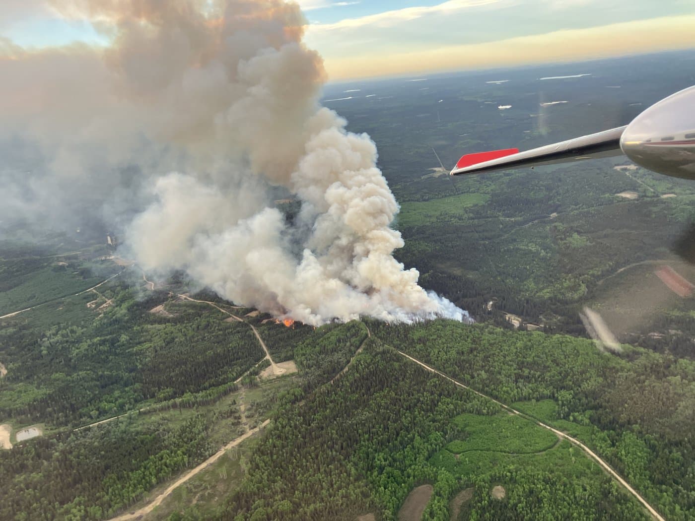
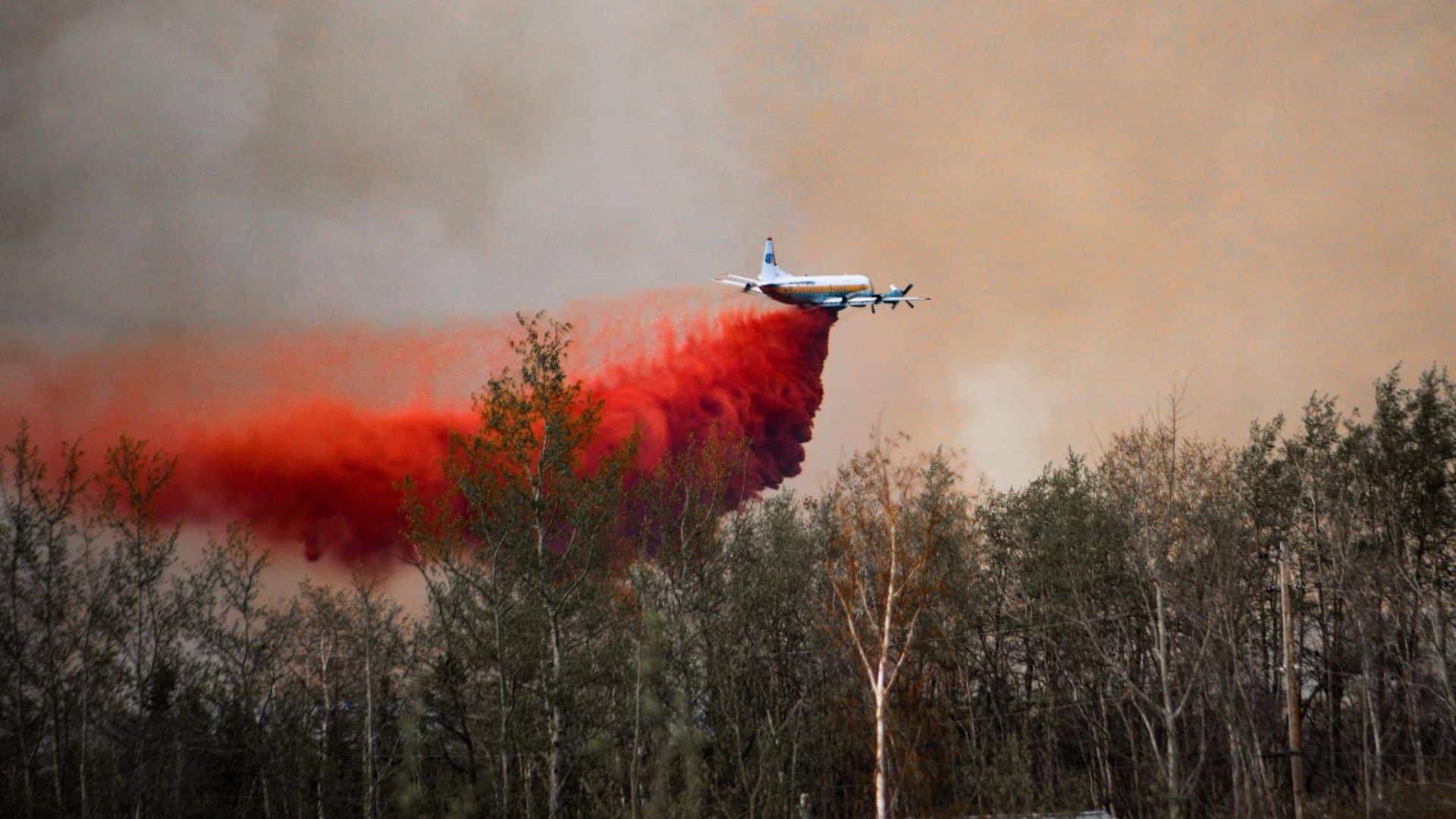
BCWS firefighters are already tackling various ‘out of control’ wildfires within the affected area, including blazes of 2,329 hectares near Etset Lake and 1,465 hectares south of the Kiwigana River.
Energeticcity.ca will update this story as more information becomes available.
Latest Stories
Stay connected with local news
Make us your
home page
Authors

Related Articles
Fort St. John seeks new emergency support volunteers as wildfire season approaches
The City of Fort St. John is looking for volunteers to help the community during evacuations and other emergencies.
Nearly 200 forest fires fought in northeast B.C. during wildfire season 2025
Wildfire season 2025 saw 199 blazes in northeast B.C., while the province saw 1,350 in total.
‘Important investment’: B.C. forestry ministry praises $257.6 million federal boost to wildfire fighting
A recent $257.6 million investment to Natural Resources Canada will go towards Canada’s firefighting capacity, including in B.C.