BCWS readies for drying to return after rain, cooler weather in northeast B.C.
The British Columbia Wildfire Service (BCWS) says a cold front of thunderstorms and showers is expected to deliver winds and precipitation to northeast B.C.

FORT NELSON, B.C. — The British Columbia Wildfire Service (BCWS) says a cold front of thunderstorms and showers is expected to deliver winds and precipitation to northeast B.C., which has been a hotspot for wildfires this year.
The latest bulletin from the BCWS says much of the province is experiencing “unsettled” weather conditions, with rain in some areas, but a drying pattern is forecast to settle in later in the week.
The southern half of the province will see showers and cooler temperatures along with some winds.
It says the risk of thunderstorms extends to parts of the Coast Mountains, with most storms bringing rain.
In northeastern B.C., a cold front was expected to arrive Sunday, delivering gusty winds and precipitation.
The service says the thunderstorms and showers will extend into the early part of the week, but a return to drier conditions is expected to start on Wednesday or Thursday in the southern parts of the province.
Environment Canada issued severe thunderstorm bulletins Sunday for parts of the southern Interior and northeast, spanning Fort Nelson and the Peace River area, as well as the Okanagan, South Thompson, Nicola and Boundary regions and northern parts of the Fraser Canyon, including Lillooet.
The weather office says conditions were favourable for the development of severe storms that could bring strong winds and heavy rain.
There are just over 70 active wildfires across B.C., with fewer than 10 of those blazes classified as burning out of control as of Sunday.
Most of the active blazes are located in northeastern B.C., with clusters on Vancouver Island and in the southern Interior.
This report by The Canadian Press was first published July 20th, 2025.
The Canadian Press
Stay connected with local news
Make us your
home page
Authors
Related Articles
Taylor Fire Rescue responded to 196 calls for service in 2025
Taylor Fire Rescue reported it responded to 196 calls for services in 2025, matching the numbers in 2024.
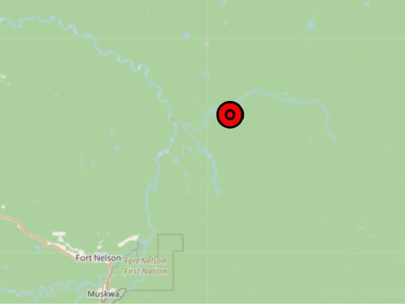
Wildfire located in area near Fort Nelson River
The fire discovered on June 16th is believed to have been caused by a lightning strike
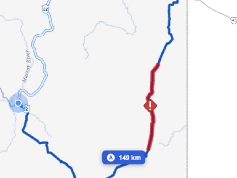
Single-lane traffic on Highway 52 due to wildfire
There will be single-lane alternating traffic daily from 7 a.m. to 9 p.m. on Highway 52 due to the Sunderman Creek wildfire.
