PRRD makes changes to evacuation orders and alerts amid Kiskatinaw River wildfire
The Peace River Regional District has made changes to its evacuation orders and alerts for properties at risk from the Kiskatinaw River wildfire.
KELLY LAKE, B.C. — The Peace River Regional District (PRRD) has made changes to its evacuation orders and alerts for properties at risk from the Kiskatinaw River wildfire.
It has issued its sixth evacuation order and rescinded its fourth order as firefighters continue to battle the fire near the Kelly Lake community.
This means people in the following areas must leave immediately, or risk fatal consequences:
- 6.8 km south of the One Island Lake Road
- Easterly for 6.7km to the B.C./Alberta border
- Southerly along the B.C./Alberta border for 2.7km
- Easterly for 5.7km, following the southern boundary of Beaverlodge Lake to a point of intersection with Highway 52 east
- Southerly along the western side of Highway 52 east for 1.7km
- 4.5km westerly to a point of intersection with the Kiskatinaw River
- Continuing westerly 8.2km to a point of intersection with One Island Lake Road
- Southeasterly for 4.7km
- Northerly for 1.7km to a point of intersection with the junction of One Island Lake Road and Noel Road
- Northerly following the western side of one Island Lake Road
- Approximately 4km to a point of intersection with the Kiskatinaw River and One Island Lake Road
- Easterly, crossing the Kiskatinaw River for 11.7km returning to a point of intersection with Highway 52 east
Evacuees are being told to go to Dawson Creek by the safest route and register for Emergency Support Services (ESS) at the reception centre in the Nawican Friendship Centre at 10200 17th Street, which will be open on June 15th from 10 a.m. to 2 p.m.
Before leaving, the PRRD says they should shut off all gas and electrical appliances other than refrigerators and freezers; close and lock all windows and doors; latch gates but do not lock them; and take pets and critical items such as ID, credit cards, medicines, cell phones and chargers, and keys
Anyone leaving should also help others seeking transportation.
Latest Stories
The PRRD has also put out a new evacuation alert, which means people living in this area do not need to evacuate, but should be ready to do so with little notice:
- Starting 3km south of the junction of the One Island Lake Road and Highway 52 east
- 6.7 km east to the B.C./Alberta border
- South along the B.C./Alberta border for 4km
- East 6.7km to Highway 52 east
- Continuing east for 11.3km to a point of intersection on the One Island Lake Road and the Kiskatinaw River
- In a southwesterly direction following the eastern side of the One Island Lake Road to the junction of the One Island Lake Road and Noel Road
- Southerly following the western side of the One Island Lake Road
- Continuing in a southerly direction for 30km passing through the eastern side of Tent Lake
- Easterly 8.6km to a point of intersection on Highway 52 east
- Continuing Easterly to the B.C./Alberta border
- Southerly along the B.C./Alberta border for 4.6km
- Westerly for 12km to Highway 52 east
- Continuing westerly for 11.9km
- Northwesterly through Blackhawk Lake for 7km to PDR 286
- Continuing northwesterly to a point of intersection with the Noel Road on the western side of Boot Lake
- Northerly, on the western side of Boot Lake, for 6.5km
- Continuing northeasterly 12.4km to a point of intersection on Noel Road
- Continuing northeasterly for 6.9km to a point of intersection with the Kiskatinaw River
- Easterly for 8km to a point of intersection with the Weaver Road and One Island Lake Road
- Continuing easterly for 5km returning to Highway 52 east
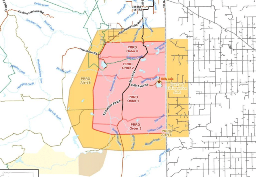
This alert rescinds alert six and orders four and five, while alerts five and seven are cancelled.
None of these affect First Nations communities on reserve lands or municipalities.
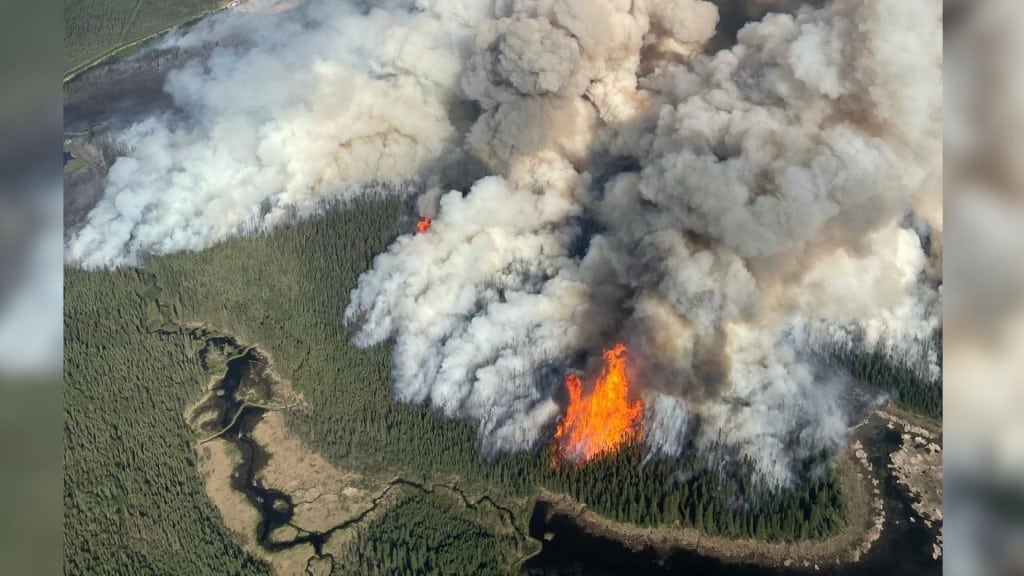
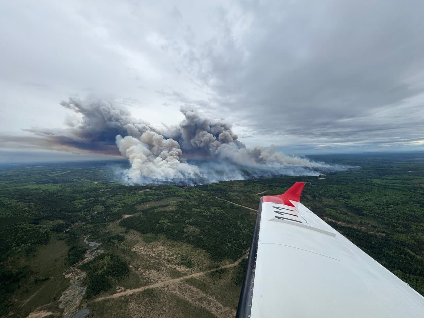
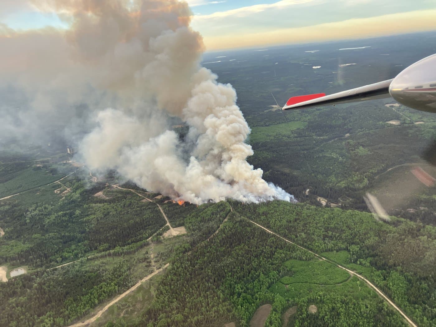
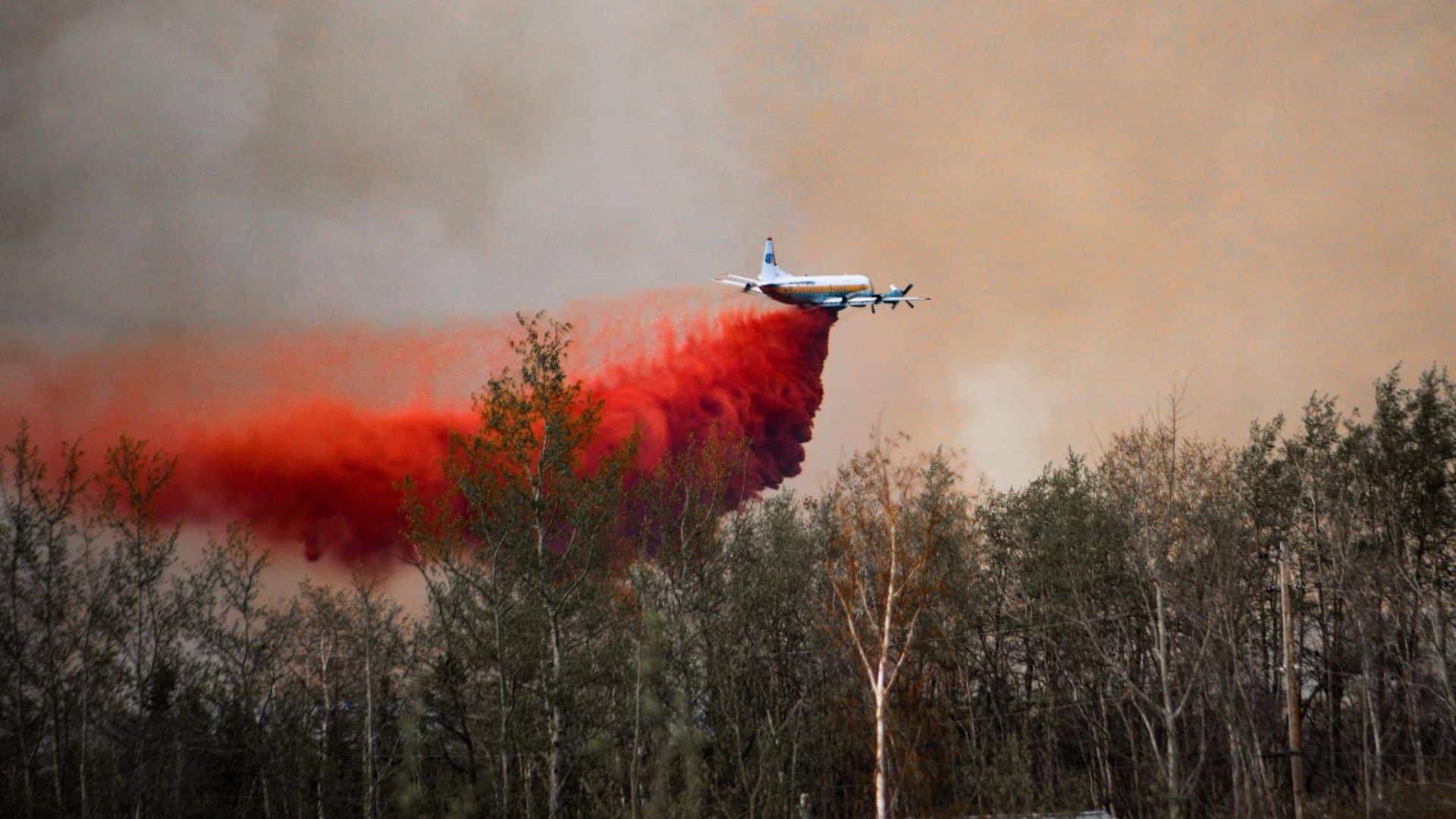
There are 115 firefighters battling the Kiskatinaw River wildfire, which the BC Wildfire Service (BCWS) says has already burnt 26,627 hectares across B.C. and Alberta.
It has damaged at least seven structures in Kelly Lake.
Highway 52 is currently closed for 18 kilometers because of the fire, according to DriveBC. The road status changes quickly, so drivers are urged to check before they travel.
This comes after the County of Grande Prairie also lifted its evacuation orders implemented because of the Kiskatinaw River wildfire.
For more information about evacuation notices issued by the PRRD, visit its website.
Stay connected with local news
Make us your
home page
Authors

Related Articles
Fort St. John seeks new emergency support volunteers as wildfire season approaches
The City of Fort St. John is looking for volunteers to help the community during evacuations and other emergencies.
Nearly 200 forest fires fought in northeast B.C. during wildfire season 2025
Wildfire season 2025 saw 199 blazes in northeast B.C., while the province saw 1,350 in total.
‘Important investment’: B.C. forestry ministry praises $257.6 million federal boost to wildfire fighting
A recent $257.6 million investment to Natural Resources Canada will go towards Canada’s firefighting capacity, including in B.C.