Persistent cold snap to continue in Peace region
The latest cold snap in the Peace region could last about two weeks, according to Environment Canada Meteorologist Derek Lee.
FORT ST. JOHN, B.C. — The latest cold snap in the Peace region could last about two weeks, according to Environment Canada Meteorologist Derek Lee.
Over the next week, Lee says the temperatures are expected to stay in the negatives during the day and evening, with overnight temperatures potentially dipping to near -30 C.
“You may see a few more flurries coming here and there this week as well,” Lee said. “It’s going to be one of those winter-like months, at least for this week.”
He says the trend is likely to continue into next week and maybe even into the middle of March before the region sees some warmer weather.
Lee says this week’s weather is colder than normal despite it still being winter, with an average of closer to -4 C or -13 C on the low end.
“It is much lower than usual, I would say more like the deep wintertime, like December,” Lee said.
“I guess we can’t complain that we actually got some precipitation in the Peace region.”
Latest Stories
When the 2023 drought monitoring season ended in November 2023, all four basins in the northeast were at drought level 5, meaning adverse impacts are almost certain, adding to the risk for the upcoming wildfire season.
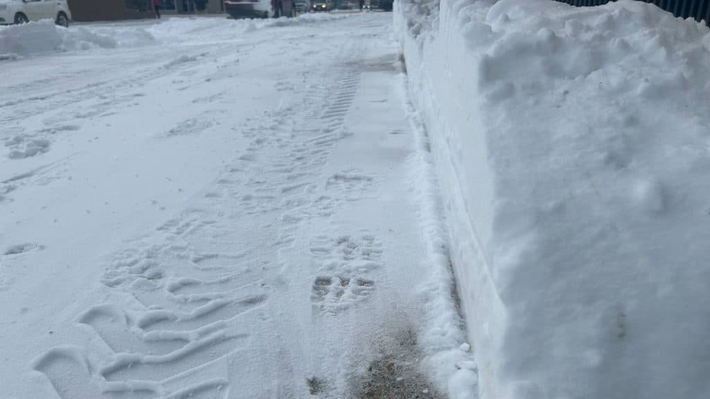
Lee says the dump of snow Fort St. John and the surrounding area received over the weekend is “not your typical snowstorm,” as two centimetres here and there is the norm. Fort St. John received approximately 10.7 millimetres from February 23rd to 26th.
“Dumps of snow are kind of uncommon to see this late in February,” Lee added.
Temperatures in Fort St. John are expected to hit a low of -35 C with the windchill overnight on Monday.
Temperatures will stay in the -20 C to -30 C range for the rest of the week.
Stay connected with local news
Make us your
home page
Authors

Related Articles

Whiskey Jack Nordic Ski Club coach named June Co-op community champion
June’s Co-op community champion is a ski coach at Whiskey Jack Nordic Ski Club and a former direct support worker.
Dawson Creek’s Walter Wright Pioneer Village to host multicultural festival
the Mutlicultural Fusion Festival is a way to celebrate diverse and different communities within Dawson Creek, says organizer.
Taylor Fire Rescue responded to 196 calls for service in 2025
Taylor Fire Rescue reported it responded to 196 calls for services in 2025, matching the numbers in 2024.
