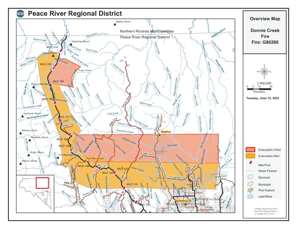
UPDATE: PRRD issues new evacuation alert due to Donnie Creek wildfire
The Peace River Regional District (PRRD) expanded the evacuation alert currently in place for the Donnie Creek and Tommy Lakes area due to the Donnie Creek wildfire.
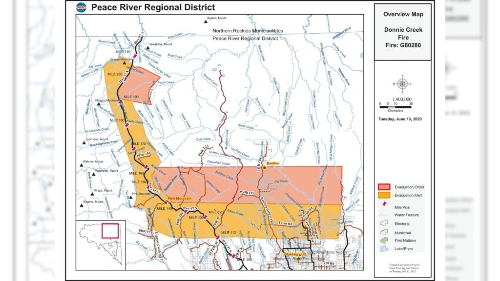
UPDATE (June 13th 4:36 p.m.): The PRRD has adjusted the evacuation alerts to include a new area along the Alaska Highway between Buckinghorse River and Trutch.
FORT NELSON, B.C. — The Peace River Regional District (PRRD) expanded the evacuation alert currently in place for the Donnie Creek and Tommy Lakes area due to the Donnie Creek wildfire.
The district expanded the alert area on Monday and Tuesday afternoon based on recommendations from the BC Wildfire Service due to a potential risk to health and life safety.
Local News Straight
to Your Phone
Download our app today!
Available on Android and iOS devices
According to the PRRD, the alert area affects over 370 civic properties, including the Pink Mountain and Prespatou communities.
The alert includes the following areas:
- 1 km north of Buckinghorse River bridge – south along the East side of Highway 97 North to km 260;
- West 8km of Highway 97 North due South to the end of Pink Mountain Road;
- South following Halfway River to the intersection of Boring Ranch Road and Cypress Creek Road;
- Due east to a point of intersection with Highway 97 North at km 177;
- Continue due east to the intersection with Beaton Airport Road at km 37;
- Continuing due east to the intersection with Prespatou Road at km 30;
- To a point approximately 5 km west of Milligan Creek Road;
- North approximately 22 km to a point of 1 km west of Milligan Creek Road;
- Due west to a point 4 km east of Pink Mountain;
- North 4 km east of Highway 97 north to a point of intersection with Sikanni River;
- Northeast for 4 ½ km to Mistahae Creek;
- Northwest to a point of intersection with the Buckinghorse River 11 km east of Highway 97 North;
- West following Buckinghorse River to a point 1 km north of the Buckinghorse River Bridge and
- Alaska Highway corridor between Buckinghorse River and Trutch.
Latest Stories
The district said the area under the Donnie Creek/Tommy Lakes evacuation alert #8 is still under evacuation alert #10, adding that there are no changes to evacuation alert #9.
The PRRD said this alert does not apply to First Nations communities as they issue their own alerts and orders.
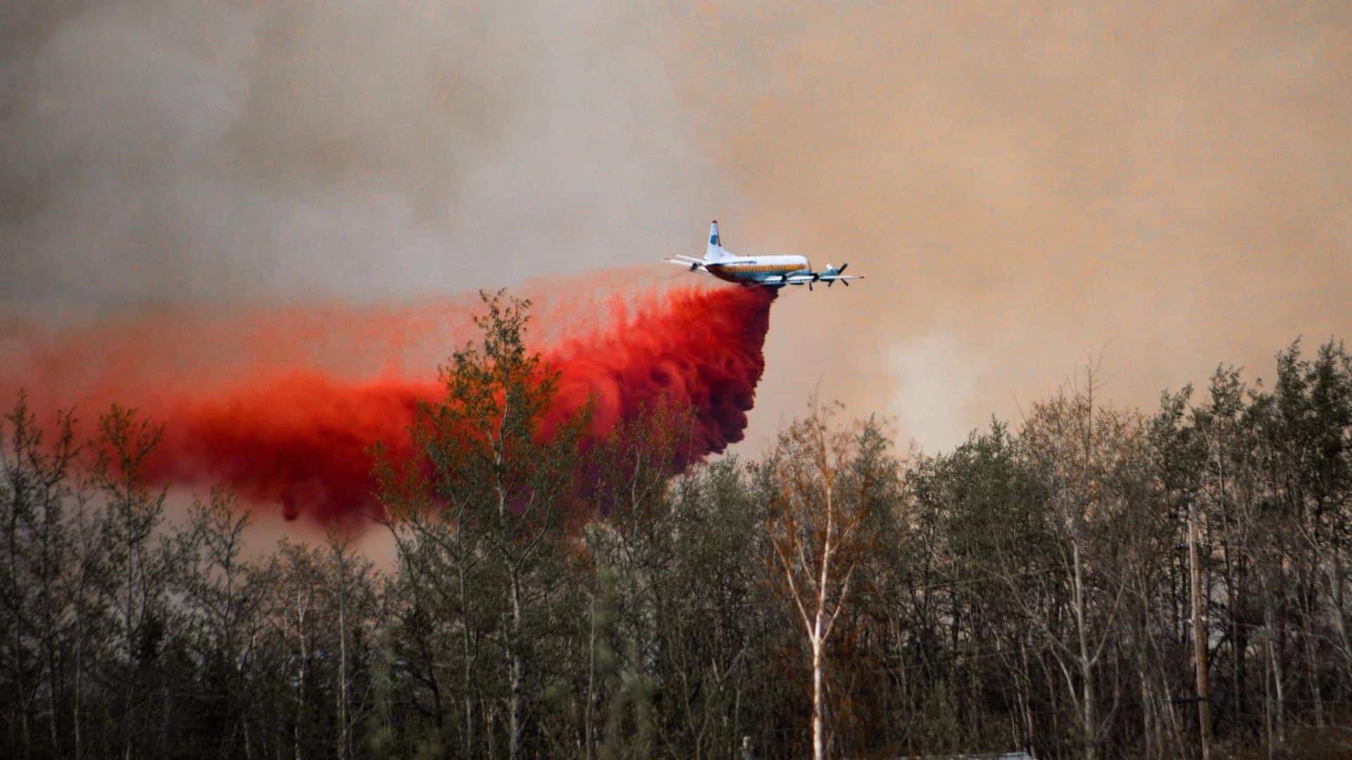
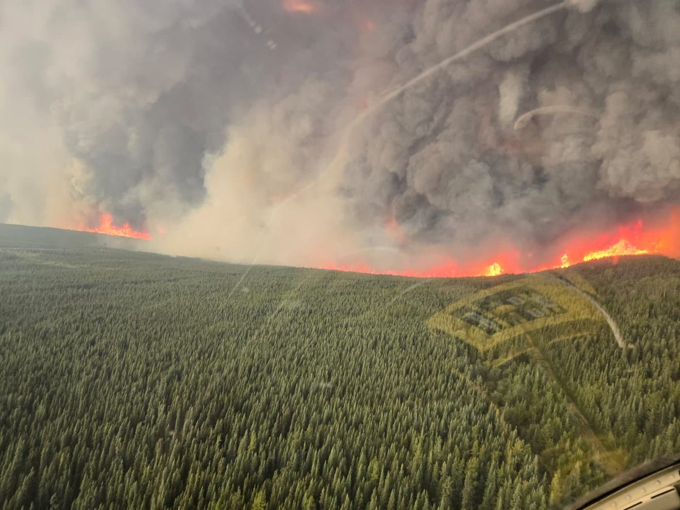
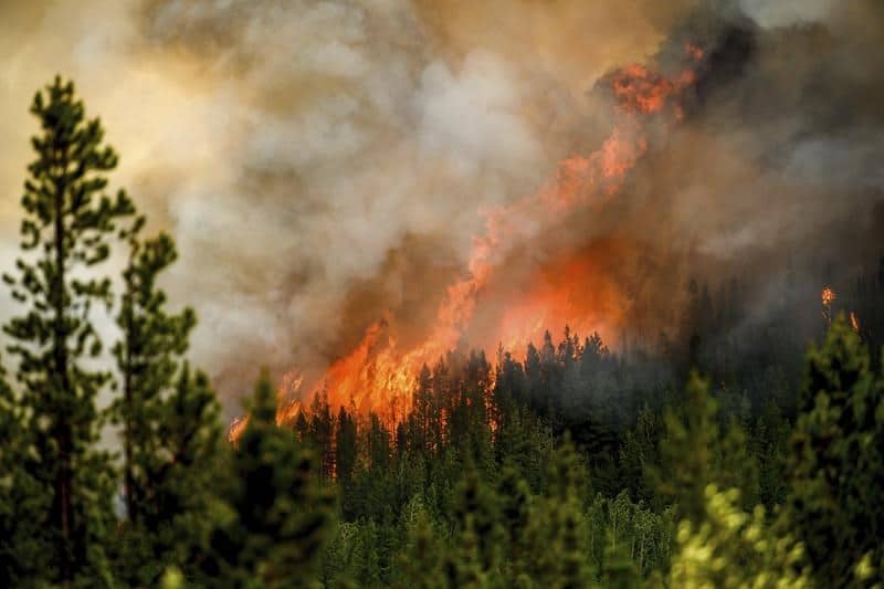
The district issued an evacuation order Sunday evening due to the Donnie Creek fire, which is now estimated at 465,955 hectares.
For more information, visit the PRRD’s website.
Stay connected with local news
Make us your
home page
Authors

Related Articles
Northeast B.C. communities to be given $86,000 for firefighting equipment
Tumbler Ridge, Pouce Coupe and the Northern Rockies Regional Municipality are the communities in northeast B.C. to receive funding for firefighting equipment from the Ministry of Emergency Management and Climate Readiness.
Wildfire training sessions to help northeast B.C. avoid ‘dangerous positions’
North America Fire Rescue is set to host wildfire training sessions in Chetwynd and Fort St. John this spring.
BC Wildfire Service readies for 2026 season with record 2,400 firefighter applications and more equipment in Prince George depot
The BC Wildfire Service has received around 2,400 firefighter applications and improved its equipment depot in Prince George in preparation for the wildfire season 2026, it said in a press release.
