1958 Taylor suspension bridge clean-up footage restored
Footage of the 1958 removal and clean-up of the suspension bridge across the Peace River in Taylor has been uncovered by Francois Arseneault, a video–based historian.
TAYLOR, B.C. —Francois Arseneault, a video–based historian, recently shared footage of the 1958 removal and clean-up of the suspension bridge across the Peace River in Taylor.
The suspension bridge opened in the summer of 1943 to replace a ferry crossing on the Alaska Highway after only nine months of construction during the Second World War.
According to Arseneault on his YouTube page Reel Life, the Alaska Highway approached the bridge from the north by cutting through a gravelled river terrace to the concrete abutment, which was constructed on shale sedimentary rock. An abutment supports the side pressure of the bridge.
Looking for something to do?
Check out our new Events Calendar!

The abutment supported a short approach span and anchored the cables that the spans were suspended from.
The bridge was 640 meters long, the longest on the Alaska Highway when it opened.
Arseneault explained that in 1946 the bridge and the highway became part of the Canadian government’s Northwest Highway System Maintained by the Royal Canadian Engineers.
Around 11 p.m. on October 15th, 1957, the bridge was closed to traffic due to the movement of the shale rock at the north abutment.
Latest Stories
A landslide on the north bank carried a million cubic metres of shale and the anchor block towards the river over the next 12 hours. The landslide overstressed the suspension cables and eventually ruptured the wires that carried the load of the bridge deck up to the suspension cables from the side. The bridge towers were damaged but remained standing while the side span and the cable supports collapsed into the river.
Due to the traffic jam on the southbound traffic on the Alaska Highway, there were hundreds of spectators but no injuries.
After a week, Arseneault said traffic was restored via a 70-ton ferry which ran until the river froze three weeks later.
The railway bridge, which was five kilometres upstream, was used as a temporary crossing by decking and curbing it and adding guardrails for the single lane of traffic. Canadian Army units provided constant traffic control.
The southern detour to the bridge reportedly crossed the Pine River by a timber trestle, which was damaged in a flood before being replaced by a modular, military steel bridge.
Both approach roads required relocation, widening and gravelling, but they functioned for two years until the suspension bridge was replaced, according to Arseneault.
Indirect costs of the collapse were felt along the highway as far as Whitehorse because traffic stopped for a week and then was delayed by the 10-kilometre diversion. Due to the delay in supplying stores, motels and service stations, the collapse also impacted the oil and gas exploration around Fort Nelson.
Arseneault said the landslide was attributed to the weathering of the shale rock after it was disturbed and exposed by the construction of the bridge approach and the water supply to the natural gas plant.
The YouTuber said Beecher Linton’s heavy equipment firm was awarded the contract to clear the debris from the river. Through Beecher’s efforts, there is a record of the challenges faced in removing the bridge from the river.
Earlier this year, Arseneault also recovered footage from Fort Nelson from 1963, depicting the day of an oil rig worker in the winter.
The 11-minute, 50-second video on 16-millimetre Kodachrome film can be viewed above or on YouTube.
Stay connected with local news
Make us your
home page
Authors

Related Articles
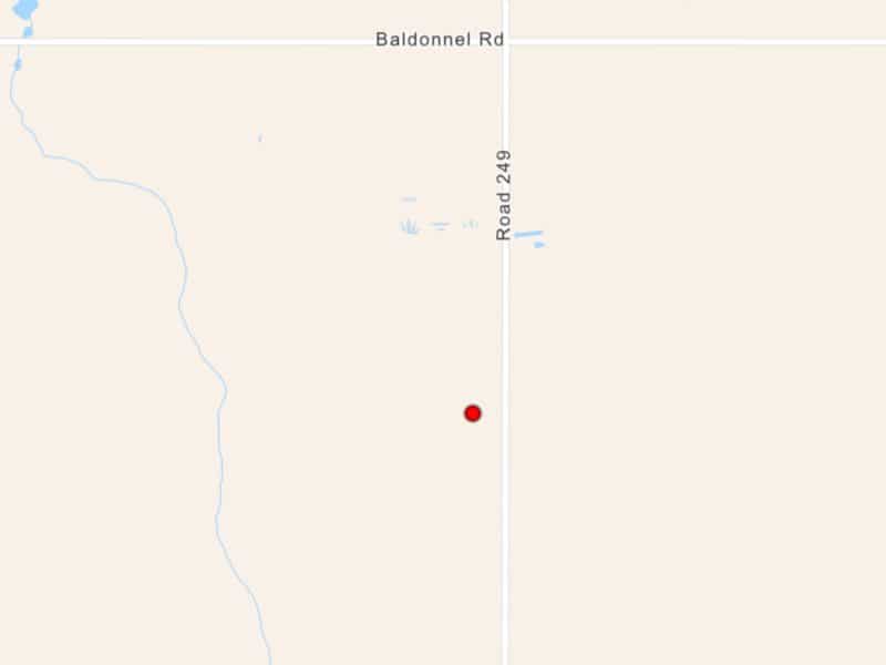
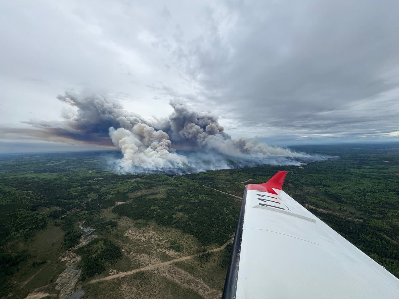
BC Wildfire Service reports a new wildfire east of Fort St. John
The four-hectare wildfire was reported during the evening of Saturday, May 2nd in the community of Baldonnel

Local cancer support group gifts care bag to resident battling cancer
Krista Fowler, a Fort St. John resident battling lung cancer, was gifted a care bag from the Fort St. John Cancer Support Society on May 1st, 2026.
BC Wildfire Service warns ‘spring dip’ to brings burn bans to Prince George Fire Centre next week
The BC Wildfire Service has stated it expects to issue burn bans for the Pringe George Fire Centre next week due to ongoing warm temperatures and dry conditions during the annual “spring dip.”
