UPDATE: Unseasonably hot weather expected to increase fire behaviour
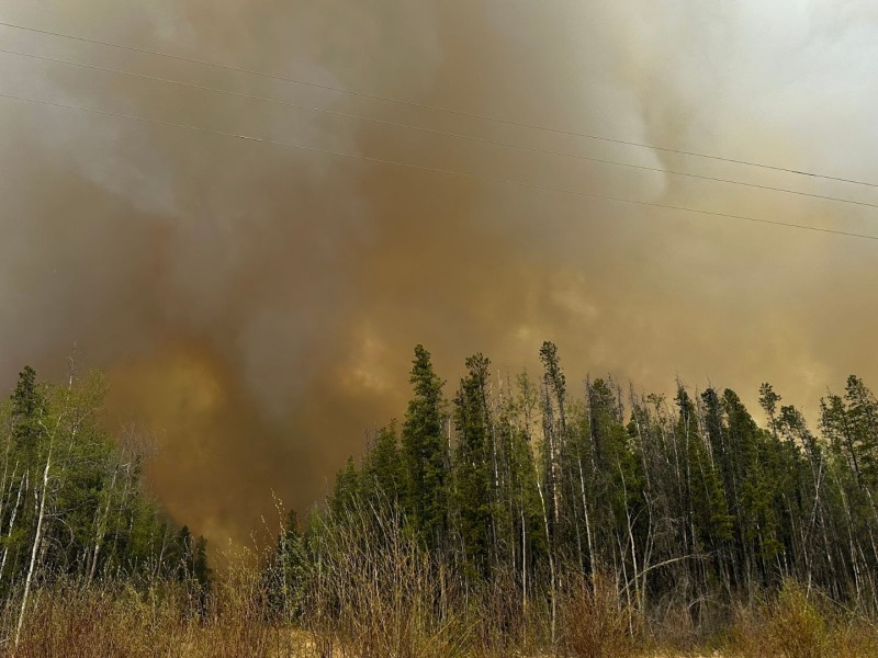
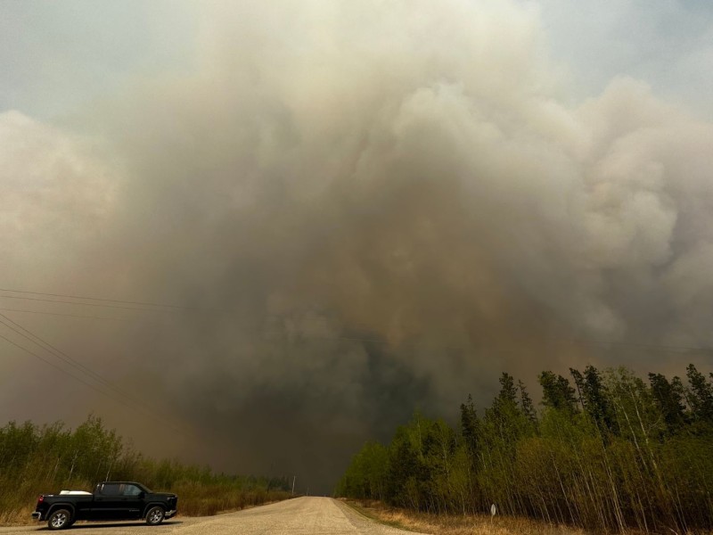
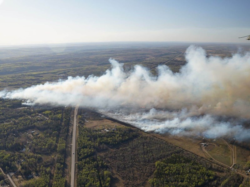
BC Wildfire Service anticipates fire behaviour in the region to increase due to the warming and drying trend forecasted for Friday and throughout the weekend.
BC Wildfire Service anticipates fire behaviour in the region to increase due to the warming and drying trend forecasted for Friday and throughout the weekend.
The Peace Liard Regional Arts Council has changed its name to Arts North East to better reflect that it encompasses the entire region.
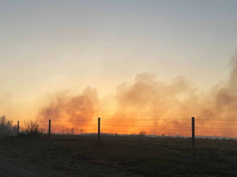
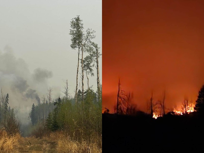
Residents have continually supported one another since the Coffee Creek and Red Creek fires sparked earlier this month.
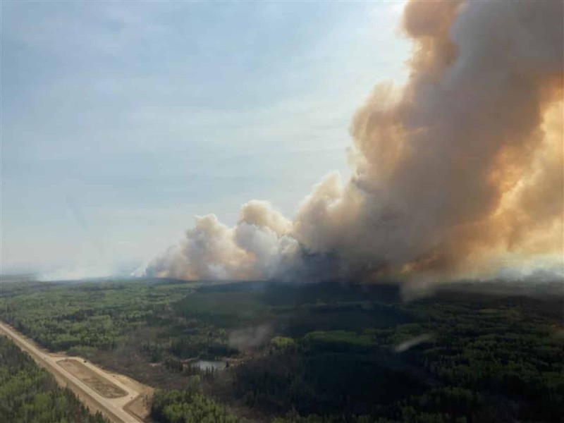
A number of structure protection personnel from across the province have been dispatched to the Red Creek wildfire due to the size of the fire and the fire activity.

While in the fire zone of the Red Creek wildfire on Wednesday, BC Highway Patrol conducted a traffic stop that resulted in a vehicle being impounded.
The Peace River Region will see unseasonably hot weather beginning on Friday.
Approximately 100 evacuees have been through the Emergency Support Services Centre in Fort St. John due to the evacuations in the region, according to the local fire department.
In a release on Monday, the nation said it was advised that the imminent risk of danger to life and property in the area had diminished.
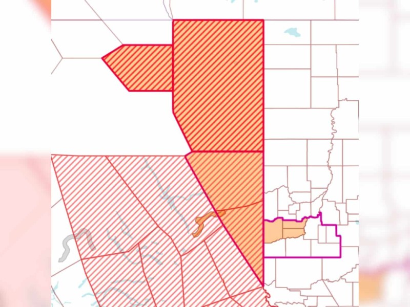
The Peace River Regional District (PRRD) has put a temporary entry permit process in place for those who need to return to areas under an evacuation order.
An incident management team has been sent to Fort St. John to support and organize wildfire suppression efforts and supply information about the larger fires in the area.
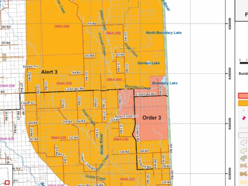
The Peace River Regional District has reduced the area that is under evacuation order due to the Boundary Lake wildfire for properties in the Boundary-Goodlow area, allowing some residents to return to their homes.
The Peace River Regional District expects wildfires in the region will continue to grow in the next 24-48 hours due to strong winds.
An evacuation order has been issued for residents of Red Creek. The Peace River Regional District issued the order Saturday morning.
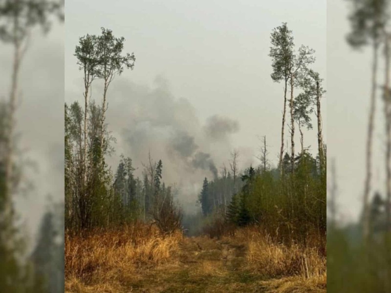
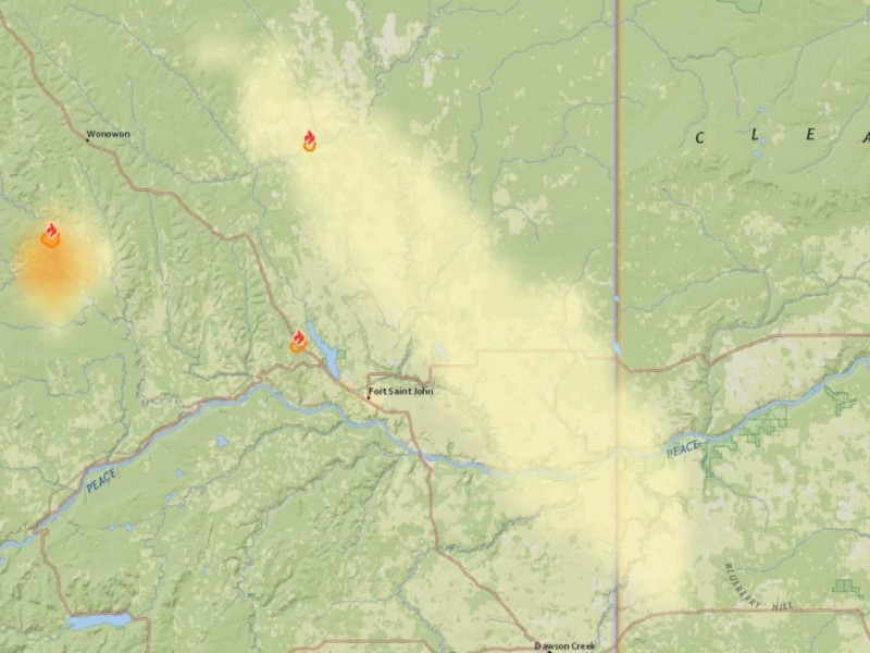
Three new wildfires sparked Friday afternoon in the Peace region.

A drone reportedly entered the restricted airspace around the wildfire in Charlie Lake Wednesday evening.
The wildfire in Charlie Lake, also known as the Coffee Creek wildfire, is now being held at 70 hectares.
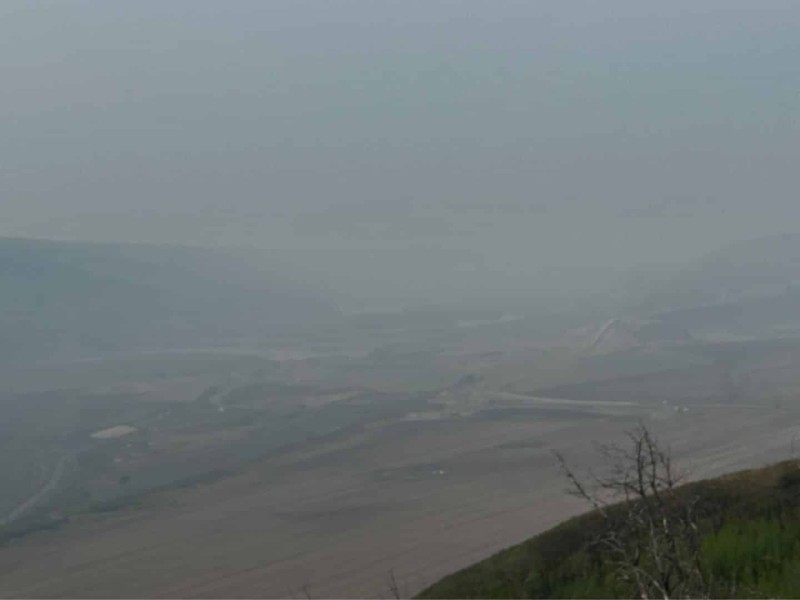
Fort St. John's air quality is considered high risk due to wildfires raging across the region.
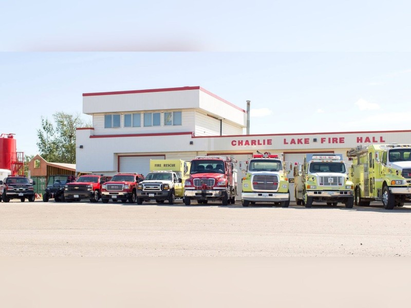
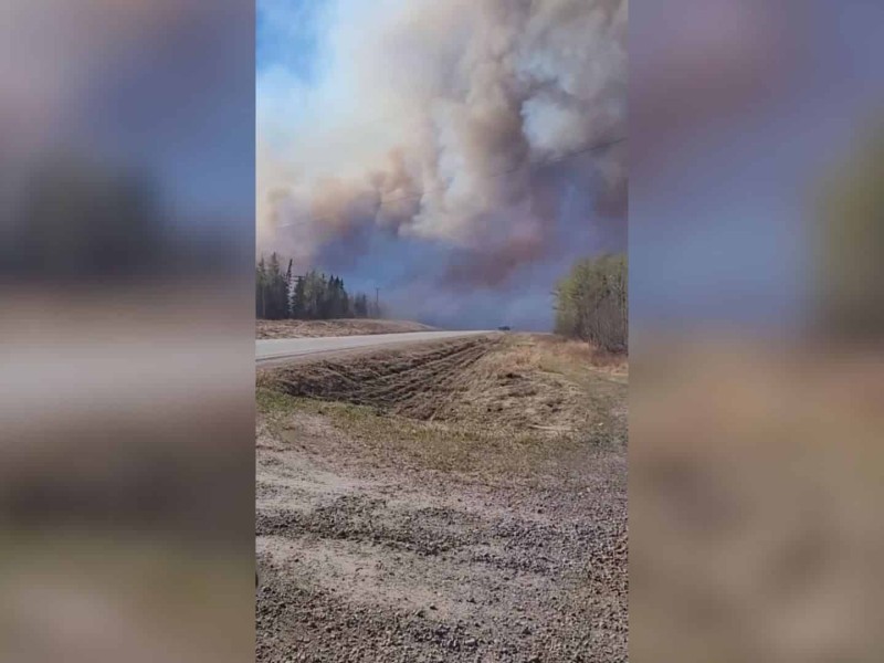
The Charlie Lake Fire Department is on the scene of another brush fire on Highway 29 and 281 Road.
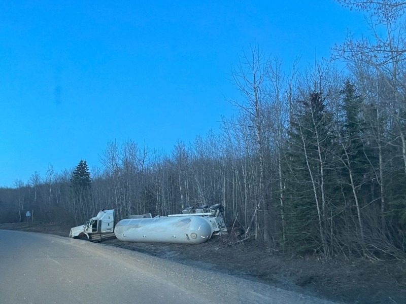
Dawson Road Maintenance and Petronas are removing a tanker that rolled over on the Montney Highway Wednesday evening.
Three new wildfires have started in the Peace region since Wednesday morning, while two existing fires have gotten out of control.
