New evacuation alert issued as firefighters continue battling Kiskatinaw River wildfire
A new evacuation alert has been issued as the Kiskatinaw River wildfire continues to rage.
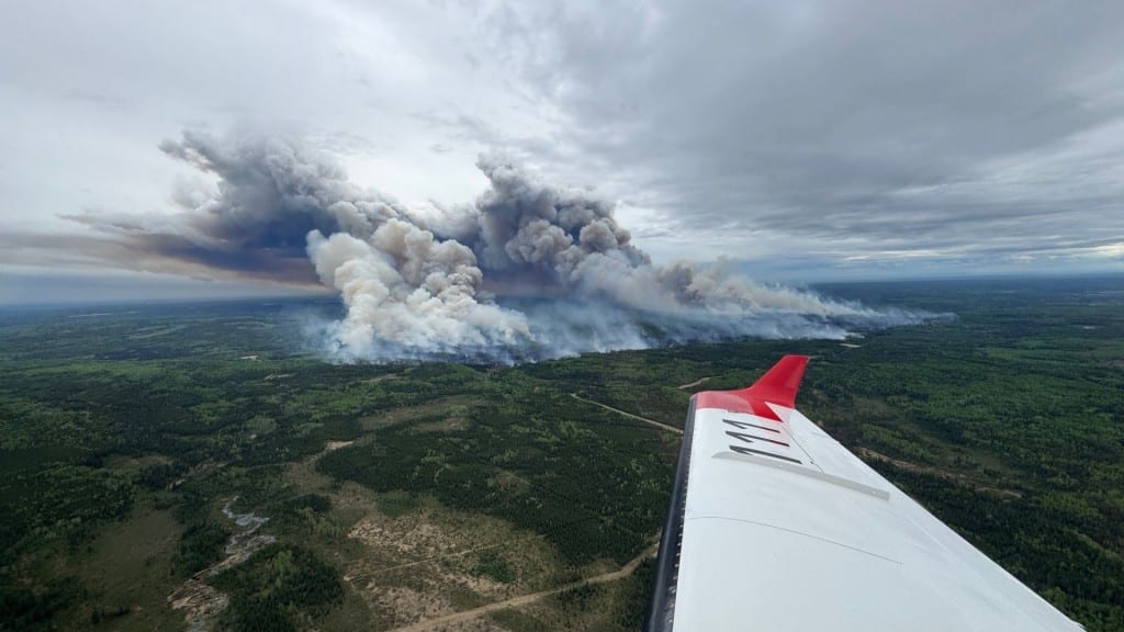
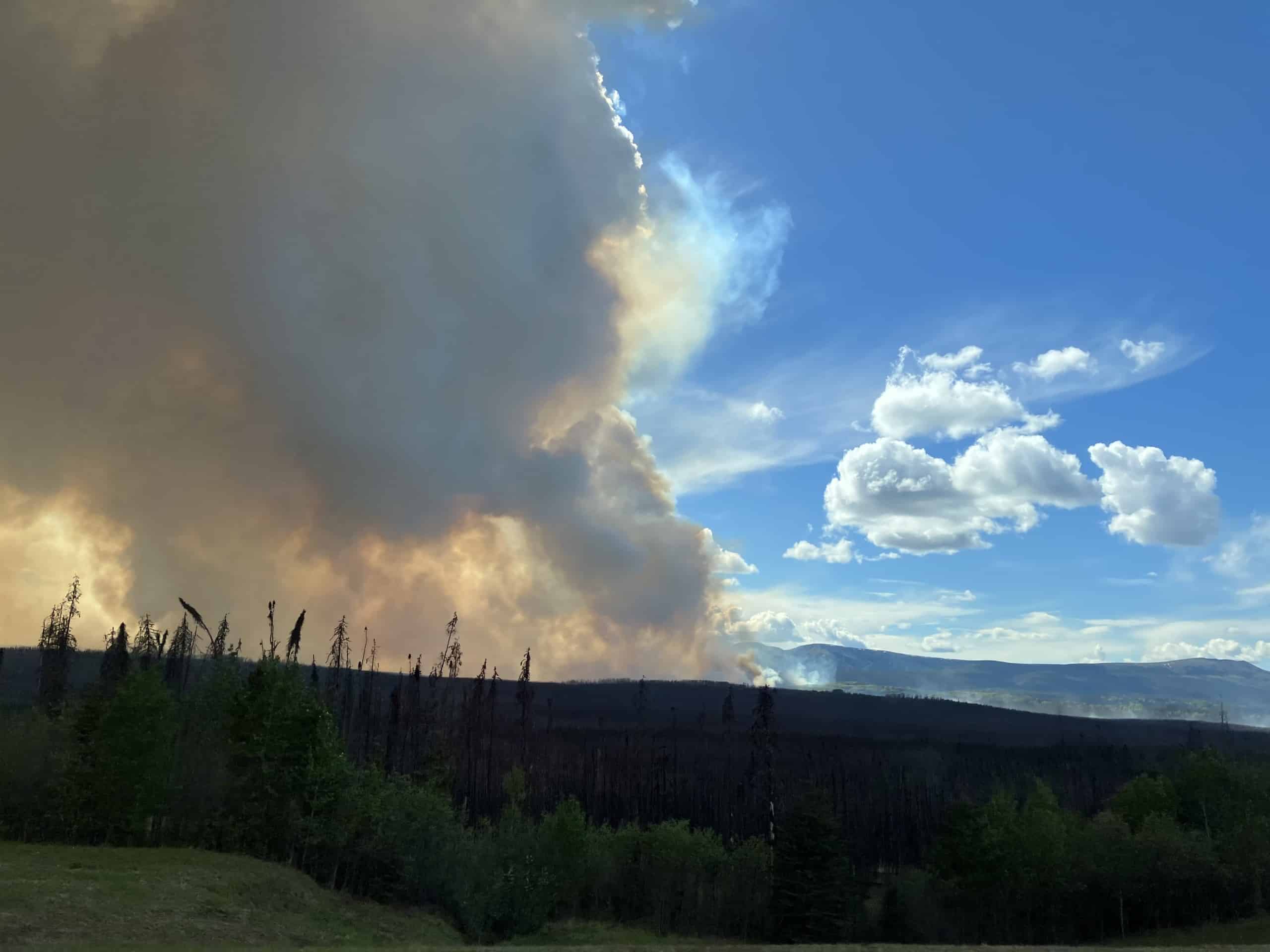
KELLY LAKE, B.C. — A new evacuation alert has been issued as the Kiskatinaw River wildfire continues to rage on.
The Peace River Regional District has issued the alert on the recommendation of the BC Wildfire Service (BCWS), which is tackling the 21,679-hectare blaze near the B.C-Alberta border.
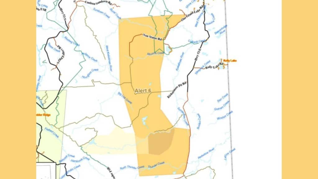
This is the sixth area to have been put under alert by the PRRD due to the Kiskatinaw River wildfire:
- From the junction of Weaver Road and One Island Lake Road, southwesterly and southerly following the western boundary of evacuation orders, from north to south – numbers four, two, one, three and five – to a point of intersection with Highway 52 east.
- West 13.8km.
- North crossing Thunder Creek and Kiskatinaw River for 13.7km.
- Northwesterly 16km to a point of intersection with Hourglass Road, which is approximately 3.5km due of west of Noel Road.
- North 20.8km to approximately Burial Creek.
- East 21.8km to the junction of Weaver Road and One Island Lake Road.
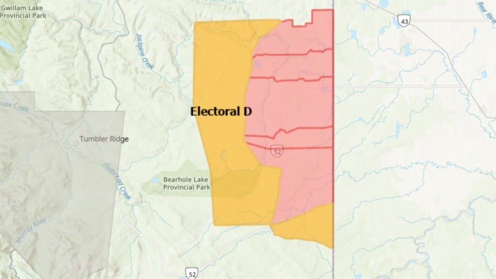
- This includes all of Bearhole Lake Protected Area and a portion of Bearhole Lake Park.
The alert does not affect First Nations communities on reserve lands or municipalities.
People living in the evacuation alert zone do not need to leave immediately, but must be ready to do so at a moment’s notice.
Latest Stories
This means locating family members and designating a meeting area outside the evacuation zone and pack essential items like government-issued ID, medication, eyeglasses, valuable papers, cell phones and chargers, and if time and space permits, personal keepsakes.
Evacuees are also advised to prepare to take pets, arrange transportation and fill the gas tanks of personal vehicles.
DriveBC reports Highway 52 is currently closed between One Island Lake Road and Hiding Creek Road due to the fire.
Details about all the evacuation orders and alerts issued by the PRRD are also on its website. The county of Grande Prairie has also issued evacuation notices, with the details here.
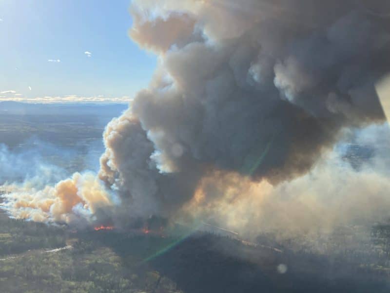
This comes after the BCWS confirmed the Kiskatinaw River wildfire has damaged some structures within Kelly Lake.
Stay connected with local news
Make us your
home page
Authors

Related Articles
Windy Creek wildfire ‘under control’ at 206 hectares
The BC Wildfire Service has brought a 206 hectare wildfire northeast of Chetwynd under control after two days.
Prophet River First Nation institutes fire restrictions in community
Signed by Prophet River First Nation Chief Valerie Askoty and councillors, it issues several curtailing of outdoor fire activity in the community south of Fort Nelson
(UPDATE) BCWS continues containment work on Windy Creek wildfire
The BC Wildfire Service are continuing to combat a wildfire discovered on May 11th northeast of Chetwynd in Windy Creek.
