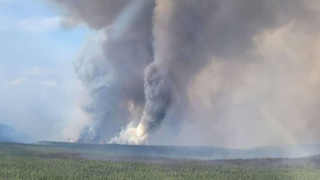
New evacuation order issued for Pocket Knife Creek wildfire
A new evacuation order has been issued due to the Pocket Knife Creek wildfire, urging some people to make their way to Fort St. John.
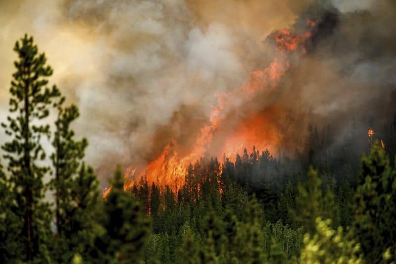
FORT ST. JOHN, B.C. — A new evacuation order has been issued urging some people to make their way to Fort St. John.
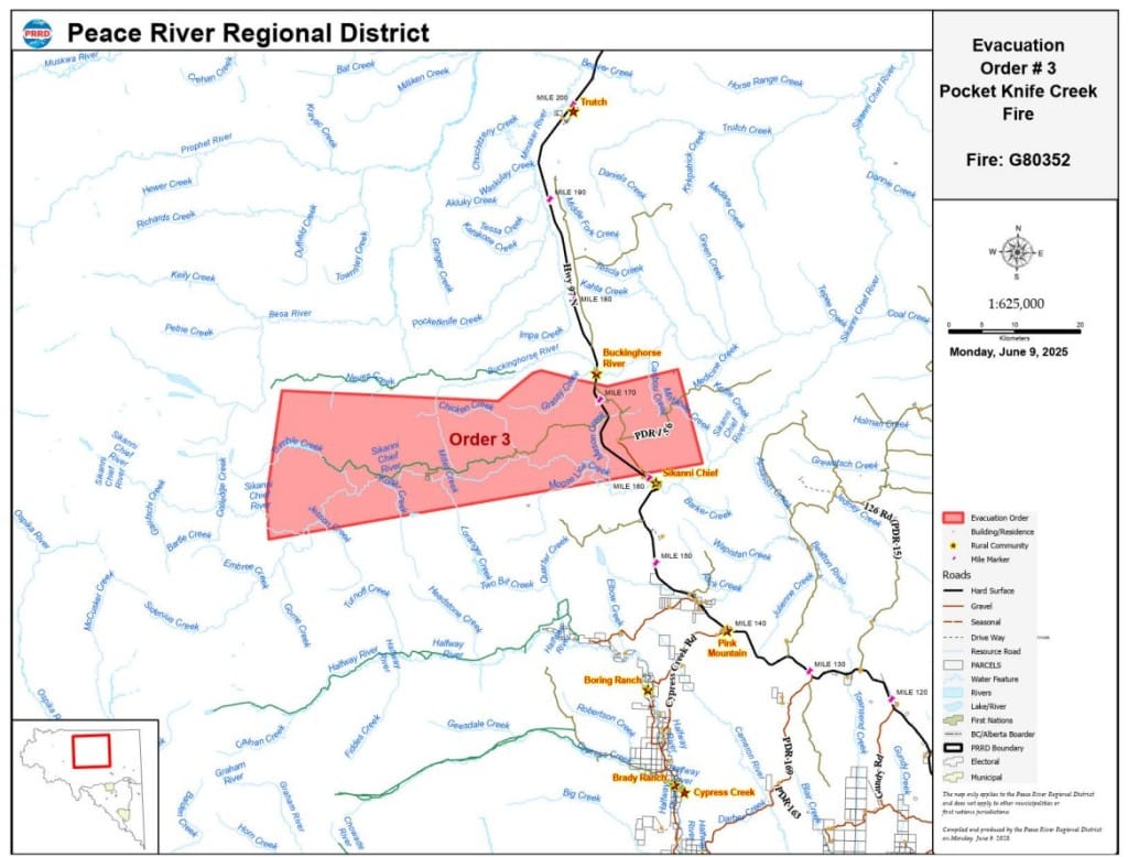
The order was issued at 1:15 p.m. on June 9th, for the Pocket Knife Creek wildfire. This new order covers the following area:
Local News Straight
to Your Phone
Download our app today!
Available on Android and iOS devices
- 1.4 km from a point North of Sikanni Chief Bridge
- From said point on Hwy 97N in a Southwesterly direction 57.5 km
- North 56 km
- To a point of intersection with existing evacuation Order #1
- Following Order #1 boundary Easterly direction to a point of intersection with the
- most Southwesterly tip of Evacuation Order #2
- Along the Southerly boundary of Order #2 to the Southeasterly most point
- Easterly 11km
- Southerly for approximately 15 km
- Approximately 10 km Southwesterly to a point of intersection with Hwy 97N
All residents within the affected area are being urged to evacuate south to Fort St. John, and make their way to the Pomeroy Sports Centre to sign up for emergency support services.
The Pomeroy Sports Centre is located at 9324 96th Street. Anyone unable to evacuate is urged to call 9-1-1.
An evacuation alert was also issued for the following area:
Latest Stories
- 1.4 km from a point North of Sikanni Chief Bridge
- From said point on Hwy 97N in a Southwesterly direction 57.5 km
- North 56 km
- To a point of intersection with existing evacuation Order #1
- Following Order #1 boundary Easterly direction to a point of intersection with the
- most Southwesterly tip of Evacuation Order #2
- Along the Southerly boundary of Order #2 to the Southeasterly most point
- Easterly 11km
- Southerly for approximately 15 km
- Approximately 10 km Southwesterly to a point of intersection with Hwy 97N
Energeticcity.ca will update this story with new information as it becomes available.
Stay connected with local news
Make us your
home page
Authors

Related Articles
Northeast B.C. communities to be given $86,000 for firefighting equipment
Tumbler Ridge, Pouce Coupe and the Northern Rockies Regional Municipality are the communities in northeast B.C. to receive funding for firefighting equipment from the Ministry of Emergency Management and Climate Readiness.
Wildfire training sessions to help northeast B.C. avoid ‘dangerous positions’
North America Fire Rescue is set to host wildfire training sessions in Chetwynd and Fort St. John this spring.
BC Wildfire Service readies for 2026 season with record 2,400 firefighter applications and more equipment in Prince George depot
The BC Wildfire Service has received around 2,400 firefighter applications and improved its equipment depot in Prince George in preparation for the wildfire season 2026, it said in a press release.
