UPDATE: PRRD issues new evacuation order for area near Doig River First Nation
The Peace River Regional District has issued a new evacuation order for a forest fire near the Doig River First Nation.
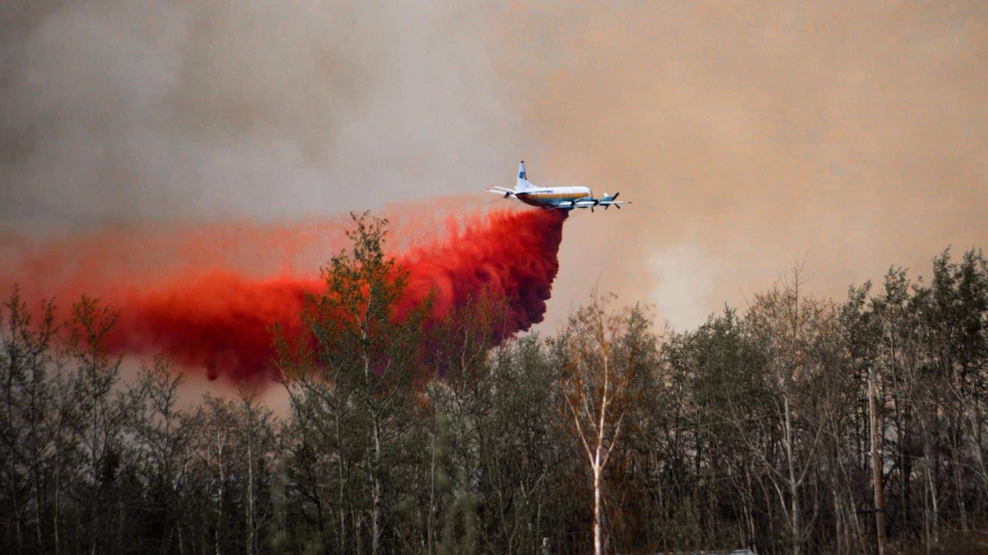
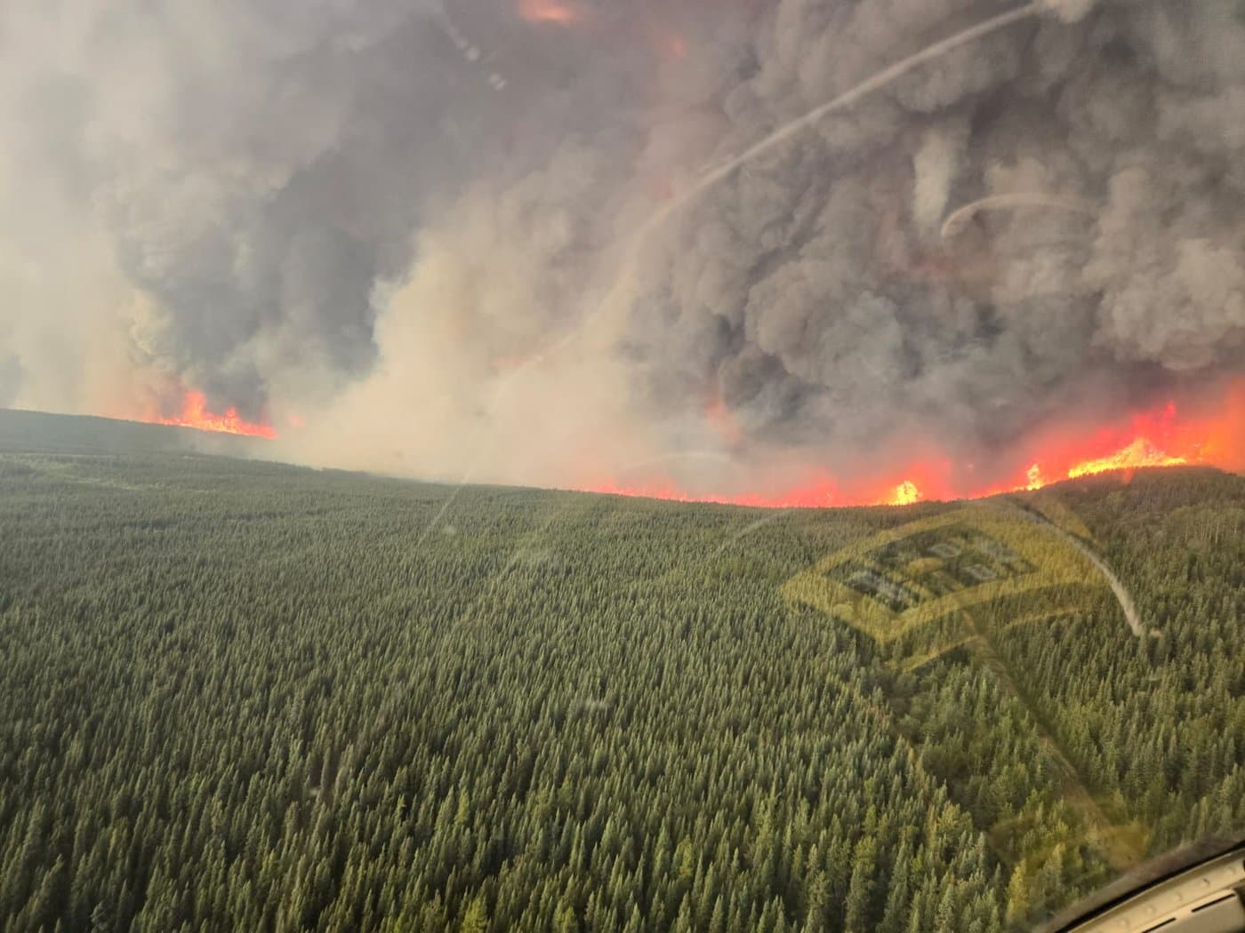
UPDATE (May 14th – 11:23 a.m.): The wildfire has grown to 597 hectares.
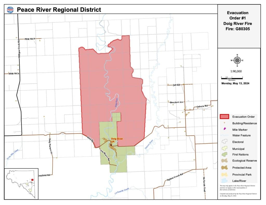
FORT ST. JOHN, B.C. – The Peace River Regional District has issued a new evacuation order for a forest fire near the Doig River First Nation.
On Monday afternoon, the Doig River First Nation issued an evacuation order for the community, and the Peace River Regional District added its own north of the Doig River First Nation.
Local News Straight
to Your Phone
Download our app today!
Available on Android and iOS devices
The fire is now over 250 hectares, and according to the Doig River First Nation, wind on Monday afternoon pushed the fire to the north of the community.
The PRRD evacuation order covers the following area:
- Km 5.75 on Doig Road
- North to Road PDR MC9
- East for 6.75 Km
- South to Doig Road
- West to Km 5.75 on Doig Road
Residents in that area are asked to leave immediately and head to the North Peace Arena in Fort St. John.
Latest Stories
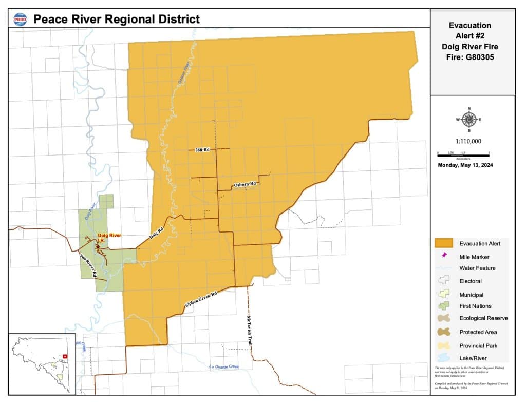
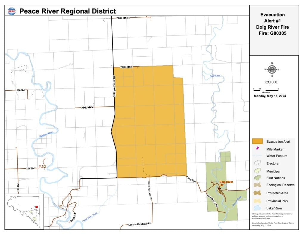
The Peace River Regional District has also issued two evacuation alerts for the same fire.
The first alert covers the following area:
- The intersection of Milligan Creek Road and Doig Road
- North along Milligan Creek Road for 9.15 km
- East on PDR MC9 Road for 4.85 km
- South for 1 km
- East for .75 km
- South to Doig Road
- West to the intersection of Milligan Creek Road and Doig Road
Anyone in that area should be prepared to leave if the fire heads in that direction.
The second alert covers the following area:
- Km 28 of Siphon Creek Road to Km 36 of Siphon Creek Road
- Northeast to Road PDR Osborn Access and continue East to end of road
- North for 5 Km
- West for 16.82 Km
- South to Km 28 of Siphon Creek Road
Stay connected with local news
Make us your
home page
Authors

Related Articles
Northeast B.C. communities to be given $86,000 for firefighting equipment
Tumbler Ridge, Pouce Coupe and the Northern Rockies Regional Municipality are the communities in northeast B.C. to receive funding for firefighting equipment from the Ministry of Emergency Management and Climate Readiness.
Wildfire training sessions to help northeast B.C. avoid ‘dangerous positions’
North America Fire Rescue is set to host wildfire training sessions in Chetwynd and Fort St. John this spring.
BC Wildfire Service readies for 2026 season with record 2,400 firefighter applications and more equipment in Prince George depot
The BC Wildfire Service has received around 2,400 firefighter applications and improved its equipment depot in Prince George in preparation for the wildfire season 2026, it said in a press release.
