Saulteau partnering with West Moberly and Chetwynd to map heat risk
Saulteau and West Moberly First Nations have begun heat mapping this week to better understand local weather patterns.
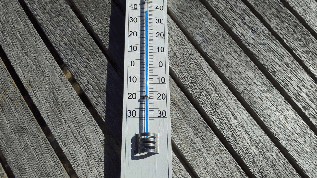
FORT ST. JOHN, B.C. — The Saulteau and West Moberly First Nations have begun heat mapping this week to better understand local weather patterns. They’ve also partnered with the District of Chetwynd for the initiative.
As of July 25th, five heat monitor sensors were installed in the community, with Saulteau First Nations making the announcement on social media. The sensors will be in place for 30 days to track local weather, and Saulteau has asked the public not to disturb the devices.
They added that the sensors have not been placed anywhere near private residences and culturally or ecologically sensitive areas.
Local News Straight
to Your Phone
Download our app today!
Available on Android and iOS devices
$60,000 in grant funding was secured in June for the project, utilizing funding from the Union of BC Municipalities under their Community Emergency Preparedness Fund. The fund was created to better understand and mitigate the impacts of climate change, with previous intakes in 2022 and 2021.
In 2021, BC experienced a heat dome, with temperatures spiking to record high levels across the province, a threat to many communities. The BC Coroners Service confirmed there were 691 heat-related deaths during the dome.
BC is also experiencing one of the worst wildfire seasons on record, with severe drought. About 400 fires are actively burning across the province. July is also globally considered the hottest month on Earth in 120,000 years, according to climate scientists.
Tom Summer, Local Journalism Initiative.
Latest Stories
Stay connected with local news
Make us your
home page
Authors

Related Articles
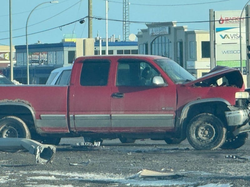
Vehicle’s hood destroyed in Highway 97 crash in Fort St. John
Emergency services were reportedly on the scene of a crash on the Alaska Highway in Fort St. John on March 31st.
Tumbler Ridge shooting victim Maya Gebala is out of intensive care: dad
VANCOUVER — The father of Tumbler Ridge, B.C., mass shooting victim Maya Gebala says his daughter has been transferred out of intensive care into a “recovery and rehab-focused unit.” David…
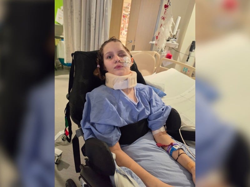
‘Hold her close and never let go’: Tumbler Ridge victim makes strides towards recovery
David Gebala has been able to hug his daughter, Maya Gebala, for the first time since she suffered gunshot wounds to her head and neck as a result of the February 10th attack at Tumbler Ridge Secondary School.
