Avalanche Canada launches new forecast system
REVELSTOKE, B.C. — Avalanche Canada has launched a new forecast system that reportedly will make it easier for residents to plan trips during the winter season.
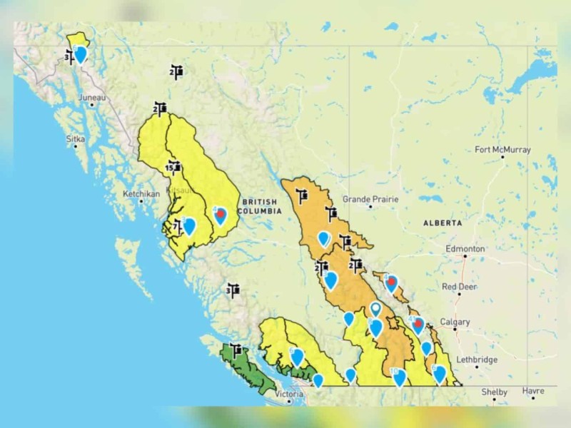
The new system is more flexible, with boundaries that change in response to conditions.
According to Avalanche Canada, when conditions are the same across large areas, there will be fewer forecast regions; however, when there are many different conditions, there will be more forecast regions.
There will no longer be fixed forecast regions or region names, as boundaries will be determined daily.
“We’ve made these changes to tackle one of the biggest problems with our old system, which was variability in conditions across large regions,” said Grant Helgeson, Avalanche Canada’s product manager.
“We’re excited about this new approach, and we’re confident it will provide a better experience for our users.”
The Avalanche Canada homepage map also has a new search functionality, where users can type in their destination in the search bar and find the corresponding forecast.
Additionally, the regions covered on the map are coloured to reflect their highest danger rating, and there is a colour-blind safe version to improve accessibility.
Latest Stories
According to Avalanche Canada, the design changes reflect best practices in risk communication and are consistent with what most public forecasting agencies use internationally.
For more information on the new map, visit the flexible forecast frequently asked questions page.
Avalanche Canada is a non-profit and non-government organization on public avalanche safety.
Stay connected with local news
Make us your
home page
Authors